It will come as no surprise to quite a few of you that I decided to cancel my overseas holidays for 2020, and spend more time exploring parts of the UK that I’ve not really been to before. I know that quite a lot of people are choosing to go abroad but that’s their decision.
This trip focuses on The Lake District and my main base was the village of Glenridding on the southern shores of Ullswater. I decided on this location as I had enjoyed the Northern end of Ullswater in my recent photography 1-2-1 with Chris Sale (stay tuned for more about that in later blogs).
Day One
My work lasted until lunchtime and I set off around about 1pm, the journey up was busy around the junction of the M61 and M6 but soon thinned out as I headed north. My route would take me up through the southern part of the lakes but then head over the Kirkstone Pass and drop down into the valley on the other side to Glenridding.
I could tell I was approaching the Kirkstone Pass as the roads got narrower and steeper and soon enough the Kirkstone Inn appeared on my right hand side, I pulled into the car park. The views from this vantage point are spectacular in both directions, and plenty of families where taking advantage of the good weather.
I’d already looked at a few Youtube clips of the Kirkstone Pass so I knew that there were good views and also plenty of car parking opportunities. On impulse I decided to take some images of the Kirkstone Pass in both directions. I’ve also invested £4.99 in a new App, called Peakfinder. Point your phone at a peak and the App does the rest, the App told me I was looking at Red Screes.
Back To Windermere 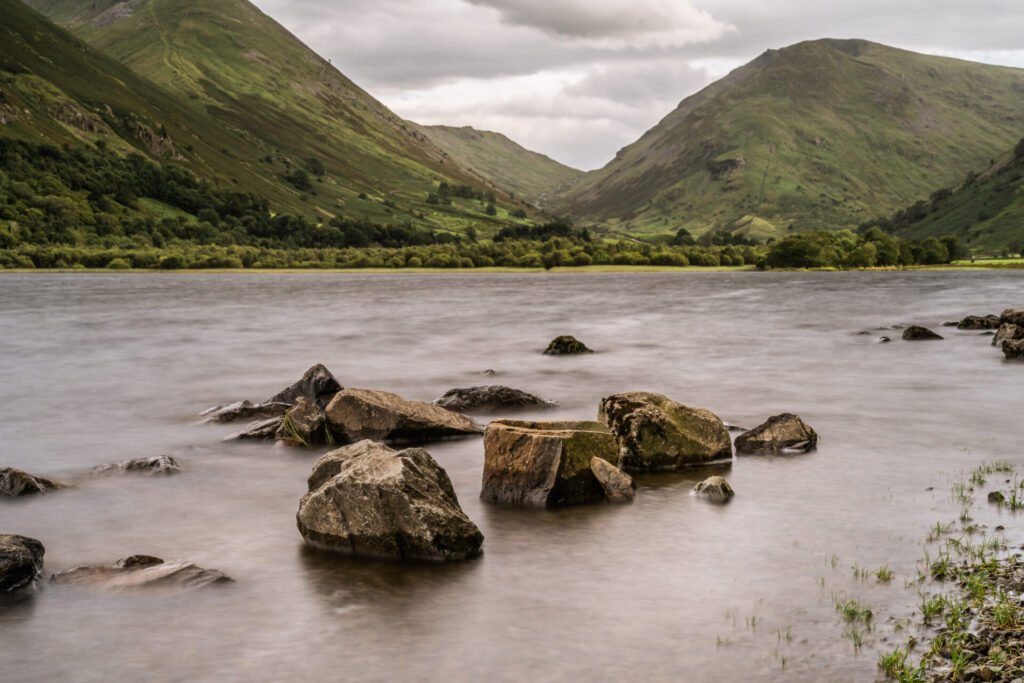
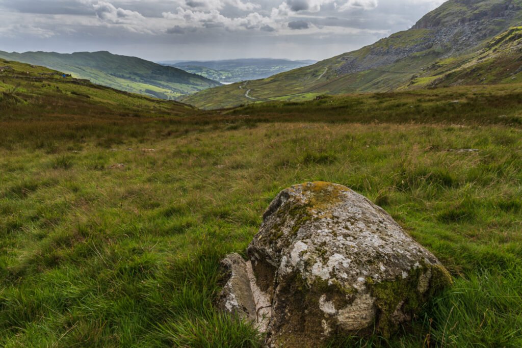
Brothers Water to Kirkstone Pass
The first image was taken looking back down valley towards Windermere from the foothills of Redscrees, there are lots of big boulders and little rocks that are useful as foreground interest. The second image was taken a little further along the Kirkstone Pass, I pulled into another car park on the downslope into the Patterdale valley. The water you can see in this image is Brothers Water.
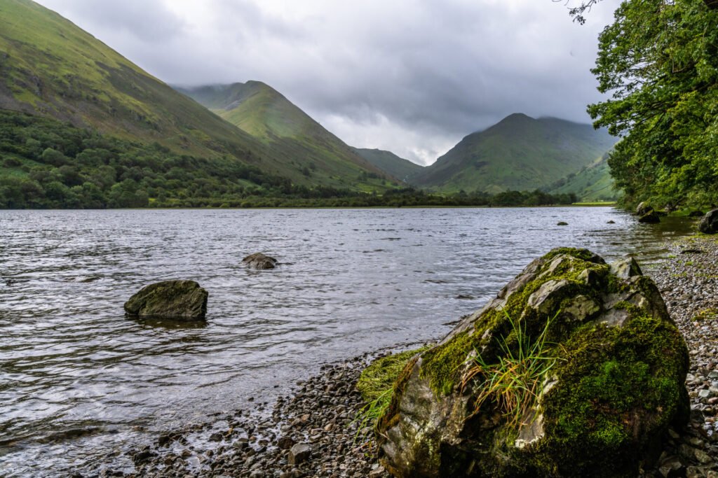
I knew a little about Brothers Water from watching some of the clips that Chris Sale has posted on his Youtube channel and decided it would be good to do a little exploring before heading into Glenridding. There is car parking very close by but it soon fills up (same in all the lakes), but I was soon on the banks of the lake. I spent a good couple of hours exploring Brothers Water and found it’s a lovely relaxing and peaceful spot. The image here is looking at Hartsop Dodd, from the beach at Brothers Water. Some nice rocks as foreground interest again, with a ND filter to help smooth out the water. I like this image.
Hartsop Dodd from Brothers Water
It was getting a little late, but I knew I was only 15 minutes away from Glenridding, so about 6pm I pulled up outside the Fairlight Guest House, my location for the next 3 nights. There will be no surprise when I tell you that I was hungry and went in search of a nice meal, which I found in the Ramblers Bar, of the Inn on the Lake Hotel. All socially distanced and bloody lovely food.
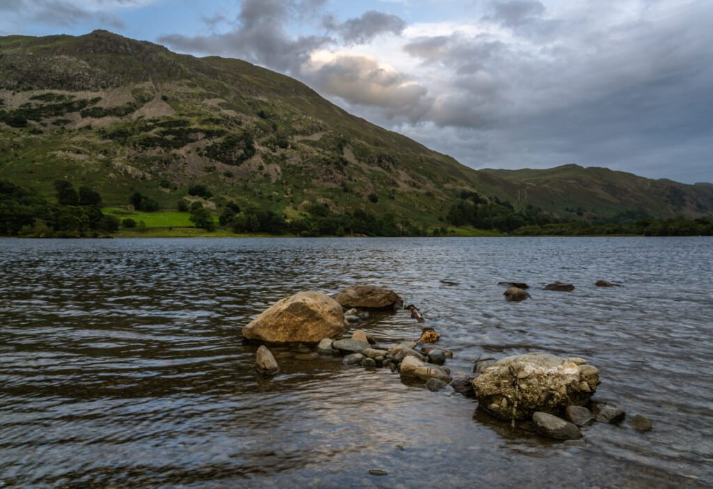
Given it was a nice evening still I decided I didn’t want to waste it and so I strapped on my camera backpack and went off to explore the beach around Glenridding. It wasn’t the best sunset that I’d ever seen but there was some nice light and colour in the sky, and the beach didn’t disappoint with some interesting shapes and textures to add to the wonderful scenes created by the fells in the background.
This first image I really love because of its dark and moody but earthy looking tones, with some nice (if weak) light in the sky off in the distance.
Glenridding Beach
The Peakfinder App told me that the big fell I was staring at was Place Fell. I’d heard of this as Chris Sale and we spoke about it as we stood on top of Beda Fell (which was the other side from where I stood on the beach). There is a famous landscape photography picture with a small tent lit up with green light on an exposed fell, the fell is Place Fell. I could see behind the fell that there was some nice light and clouds working across the sky, and I wanted to get an image that had Place Fell within it. The light looks great on this image and it shows how much difference a short space of time can make to the textures, colours and tones of an image from the same location.
Towards Place Fell
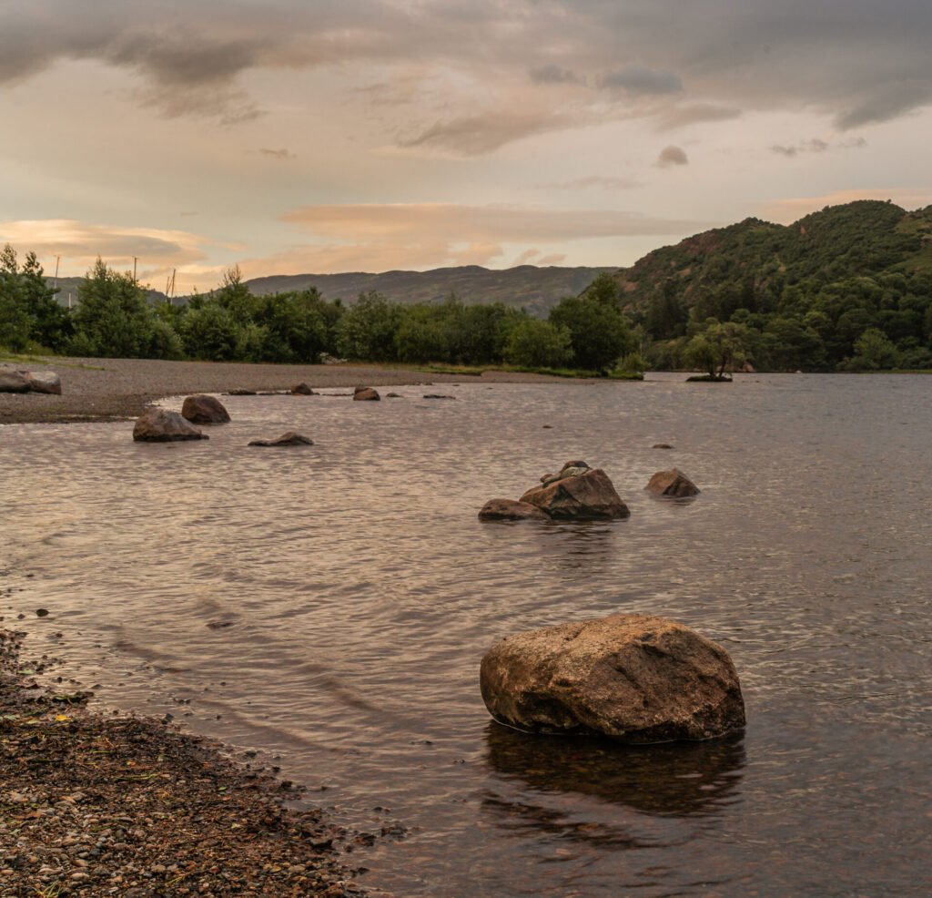
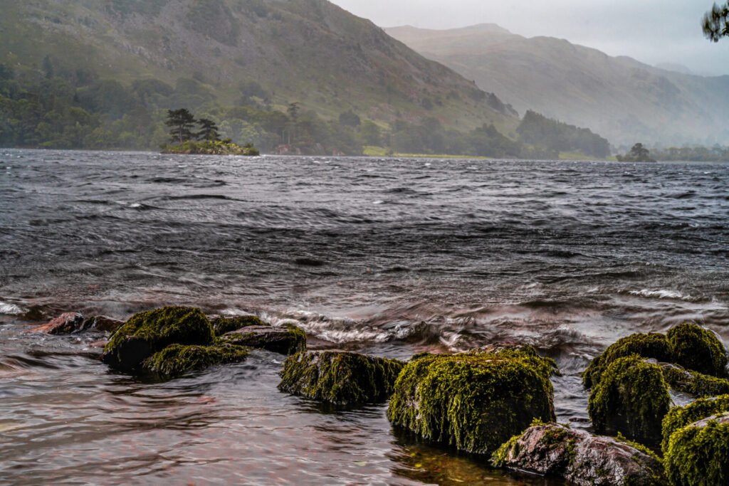
It struck me how still, almost serene feeling I had as I stood on the beach looking to see what other compositions I could find. The beaches are not deckchair and ice cream type beaches, far from it. They are pebbles and small stones, but this provides a great deal of shapes and opportunities for images. This last image from beach is looking out over Ullswater but from low down, capturing the contours of the stones, as well as the shapes and reflected light that came from the slowly fading light. I could have stood there for hours.
Glenridding Beach – Serene
Day Two
The weather forecast was spot on, as I opened my curtains just before I had my breakfast on Friday morning. It was tipping down. Curiously this made me more determined that I was going to go out and take photographs.
My plan for Day two was to take the Ullswater steamer, get off at Howtown and then do the Hallin Fell circular walk. This would get me back to Howtown in time for the return steamer ride. It wasn’t a surprise when my phone rang to be told that the bad weather had forced the cancellation of all steamer journeys for the day.
I packed my waterproofs and set off to drive in the general direction of Pooley Bridge. I didn’t get far found the Glencoyne Bay car park and sat there for a short while, contemplating what to do next. I decided to drive to the foot of Hallin Fell and at least I could see what it was like in preparation for next time. The bridge at Pooley Bridge is being replaced so you have to drive all the way to Penrith to get back around the other side of Ullswater. The rain got heavier and heavier, as I approached Howtown, and I realised that this was the route that I had followed Chris Sale down on my 1-2-1 the previous week. It’s a narrow track and lots of crossing points got used as I navigated my way to the church at the base of Hallin Fell. I am now prepared for when I can hike this fell in better weather.
As I drove back the rain eased and I was able to pull into a few laybys I’d seen and attempt to take a few images around Ullswater. I scrambled down a bank and got onto a beach that gave me views of Hallin Fell from across the water. This first image is one of the shots I took on that beach. Mean and moody weather, but good shots nonetheless.
Towards Hallin Fell
The route back took me to Glencoyne Bay and the rain stopped for just lomg enough for me to explore the beach. The shot back towards Pooley Bridge I did take but with no decent light or sky it wasn’t the most appealing. I did find some mossy rocks on the beach hidden in some trees and took a number of shots here. Various shutter speeds, ND filters and the polariser all got a work out, but the image here is the one I like best from that 45 minutes before the rain started.
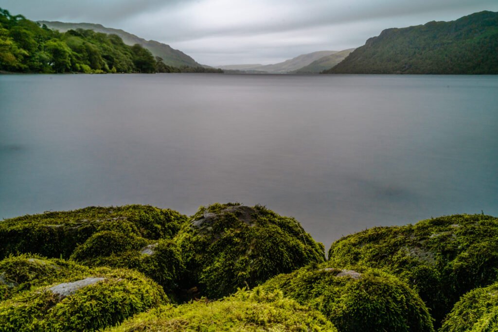
Glencoyne Bay – Mossy Rocks
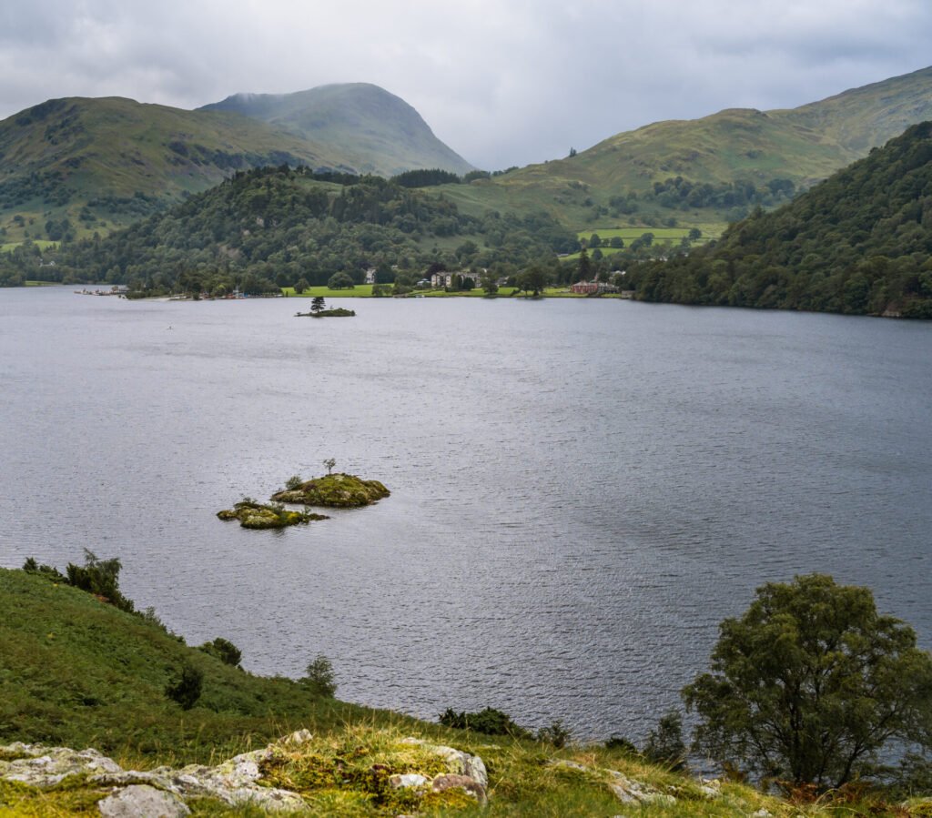
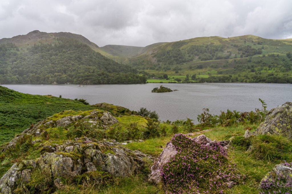
There is an official walk that goes all the way around Ullswater (The Ullswater Way), and so I decided to hike a little way along this, just to explore. The great thing about walking is that you meet so many lovely people. I spoke to lots of folk throughout my whole trip but I met a lovely couple with their son, who was interested in what I was doing with all the camera gear stuck on a tripod in the rain. A pleasant 15 minute socially distanced chat I had with them. What I was after was an image of one of the small islands that sits in Ullswater. The image here is the best of a bad bunch but you get the sense of what I was trying to achieve and the elements I was battling against.
The Elements
At this point I decided I needed a cup of coffee and to get warm again. The camera stayed in the bag that evening, it was far too wet and windy outside.
Day Three
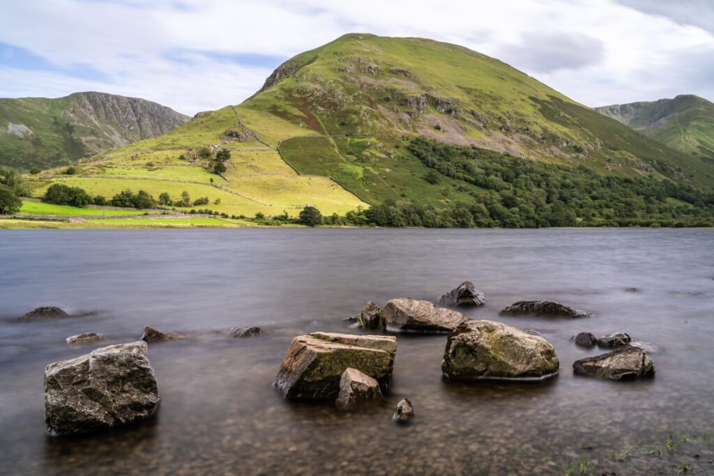
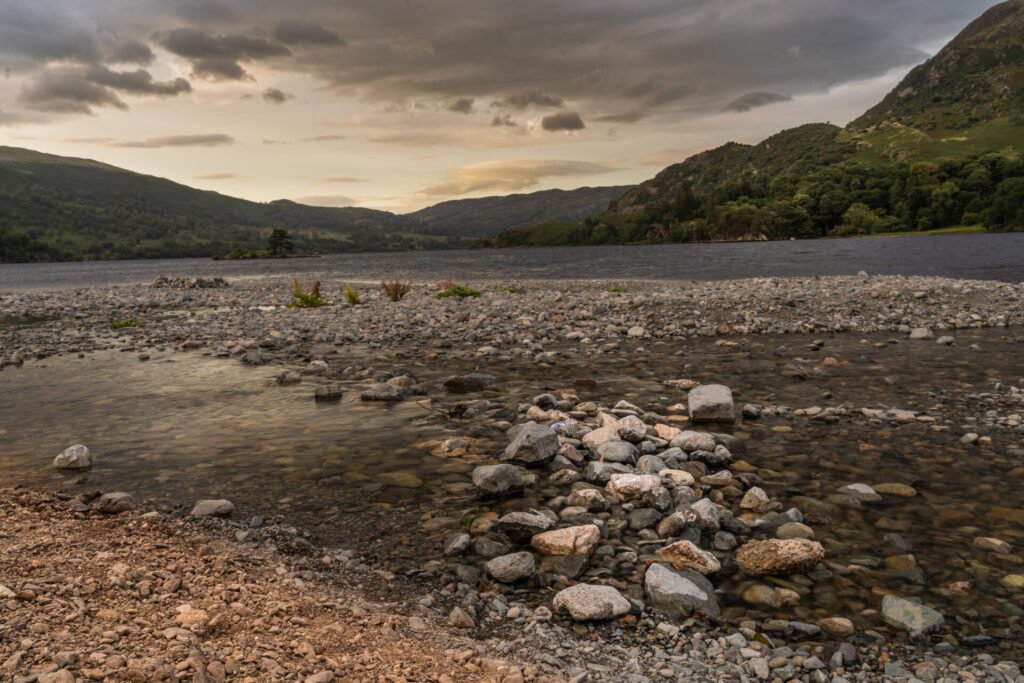
Thankfully the weather forecast for Saturday was much better and whilst it wouldn’t be cracking the flags, it wouldn’t be quite so torrential rain. I set off with the intention of walking from Patterdale on the circular route to Silver Bay. I ended up driving through Patterdale as all the obvious places to park where taken, at 9am!! So Brothers water appeared and I took a few more images on the beach looking back at the Kirkstone Pass, this first image is from this shoot.
Brothers Water towards Kirkstone Pass
As I stood there I suddenly thought my plan was to walk to Silver Bay and that was what I was going to do. I managed to find a car parking spot in the less than obvious overspill car park opposite the Patterdale Hotel. The route to Silver Bay is part of the Ullswater Way and has an upper and lower path. I decided to follow the lower path to get there and the higher path back.
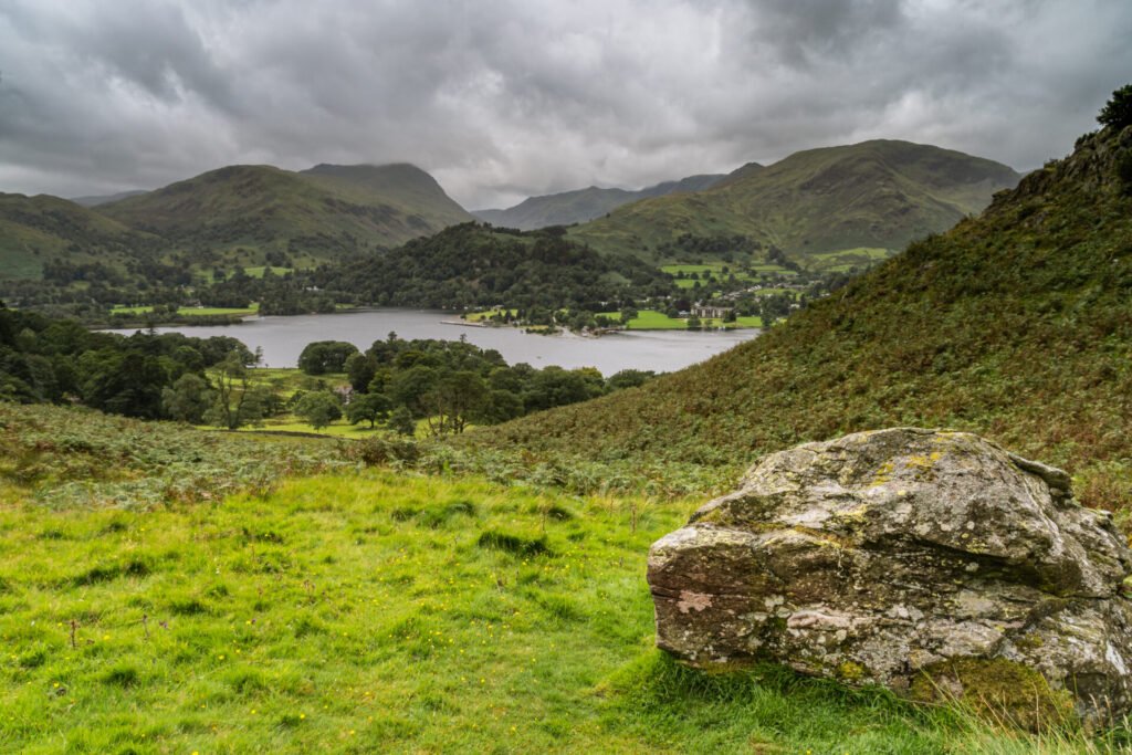
It was a lovely walk, the odd bit of rain, but some amazing views I just wouldn’t have had otherwise. At Silver Point I had views over to Glenridding, Glencoyne and also out down towards the general direction of Pooley Bridge.
This first image gives the view back towards Glenridding as well as views of the small islands I had been trying to capture from the opposite bank.
To Glenridding
I stood for quite a while on one of the rocky bits of Silver Point and took in the views of the fells across the water. As I stood I could see that light was starting to flow through the clouds and light up the fell sides across the water. Given that rubbish weather it was great to see some of the sun’s rays come shooting through and illuminating the fells. This next image is of Galbarrow (I think), its lovely whatever its called.
Illuminated Galbarrow
I had a quick chat with a chap who I’d passed earlier who was with his family but he had left them behind as the little dog with them wasn’t for walking very far or any form of pace. Just chit chat but great to have a good chat with folk. It started to rain so I took shelter of sorts under a tree on the top of the rocky outcrop. As I sat there waiting for the rain to pass I saw a lovely clump of heather, that made a lovely foreground element to an image with the fells in the background.
Nice Heather on Silver Point
My map told me that the higher path ran behind Silver Crag, and so off I went on my way. It was a bit of a hike up but the views at the top were lovely. I decided against getting the camera and tripod out as it was raining very hard at this point and blowing a gale.
As I dropped down the otherside of Silver Crag, this offered a bit of shelter but also some lovely views over to Glenridding. Thankfully the rain had eased and I took a number of images from the higher path looking over the water at the fells.
Views from The Ullswater Way 
Moody Glenridding
The hike back down into Patterdale was lovely as the sun came out and I stopped and chatted with a number of couples all who were interested in my photography. There is a shop in Patterdale Village and they do wonderful bacon baguettes, and cups of coffee which is what I needed after that hike.
I wandered around Glenridding and bought a map of the Wainwrights from the gallery in the village and also enjoyed another cup of coffee whilst exploring.
The day was rounded off with a lovely Chicken Curry and a couple of socially distanced beers in the Travellers Rest pub, just up the road from the guest house where I was staying. I slept soundly that night.
Day Four
My original plan would be to travel back to Manchester on Sunday, as I had a forlorn hope that maybe my beloved Manchester City would be in the Champions League final. I stayed another night but this time I moved on to Grasmere, I’d booked into a lovely B&B Chestnut Villa. This was gorgeous accommodation.
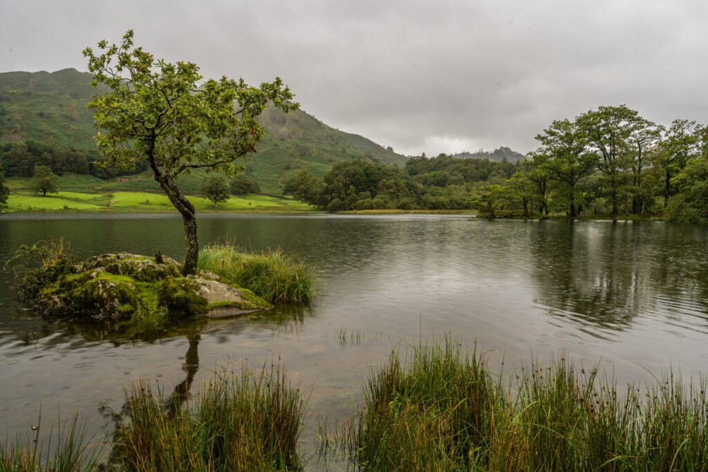
When in Rome. So I decided to go in search of the obvious shots from Rydal Water on the Sunday morning. I drove through a very foggy Kirkstone Pass and dropped down into Ambleside and then onto Rydal. The Car park at Whitemoss is great and very close to Rydal Water.
The forecast was for rain but not until maybe 2pm. So, at 10.30m I set off looking for the lone tree and the boathouse. I found the lone tree easily enough and even found the gate into the field. The surrounding area was very wet and whilst there was a bit of mist this was on the fells rather than the water.
I couldn’t quite get close enough or low enough to get full separation of the tree from the background but I’m pleased with my first attempts.

Rydal Lone Tree Version 1
At this point it started to rain and you can see this in the last image I took of the lone tree. This time the tree is in the left of the shot with a (bad) reflection of the trees on the opposite bank in the water. I shall return to this spot in the future.
Rydal Lone Tree Version 2
A good chunk of the walk around Rydal Water is on the main road. Whilst this makes for easy walking it’s a bit noisy as the masses of cars headed off into the various locations around Grasmere and Rydal. I came across another gate that had a sign that said payment was required to fish at that spot. I wasn’t fishing so I wasn’t going to pay! What I did see where some good vantage points looking at the Boathouse in the corner of the lake, as well as views of Loughrigg Fell.
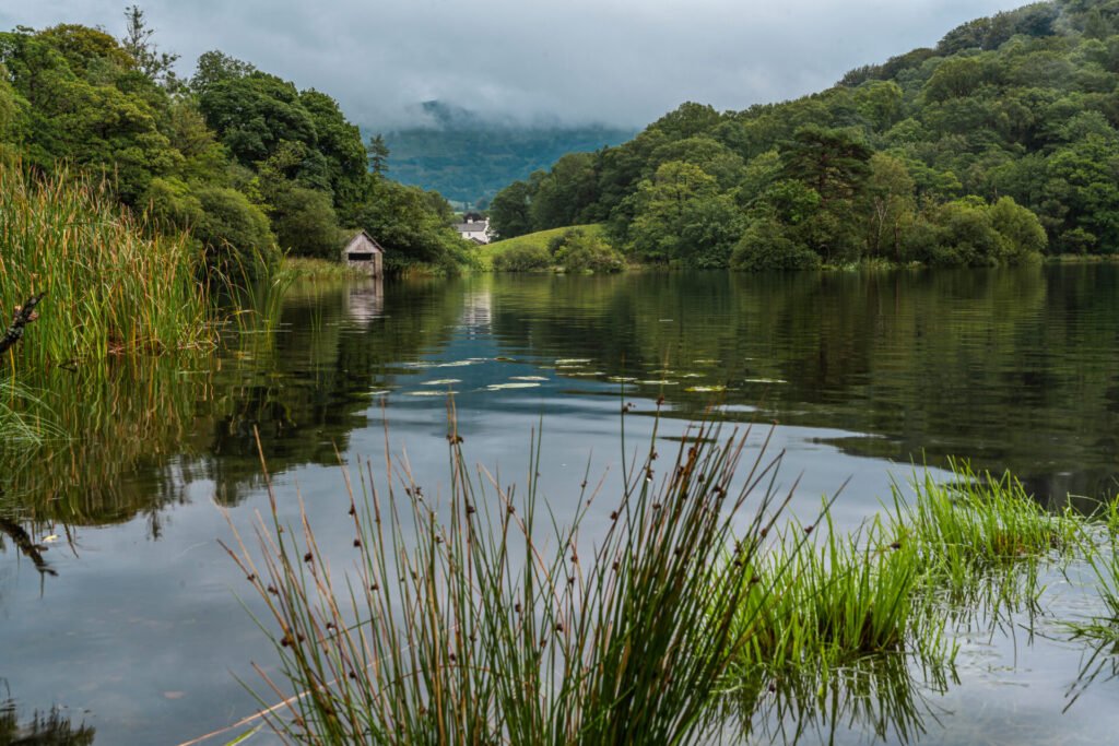
The Boathouse Version 1
This first image of the boathouse uses some of the reeds and lilly pads as foreground interest, and I’m quite pleased with this first image.
I could see across the water that there was another vantage point where I could shoot the boathouse, so off I went. The path led me from the clump of trees down to the waters edge. A lovely couple had set up a tarp for shelter and I spent a lovely 15 minutes chatting with this couple from Ramsbottom.
I set up the camera and took a few different portrait and landscape images of the boathouse from this alternative vantage point, and this final image I’ve chosen is a landscape shot, with a few fuzzy reflections but also captures the fell (Nab Scar I think) in the image.
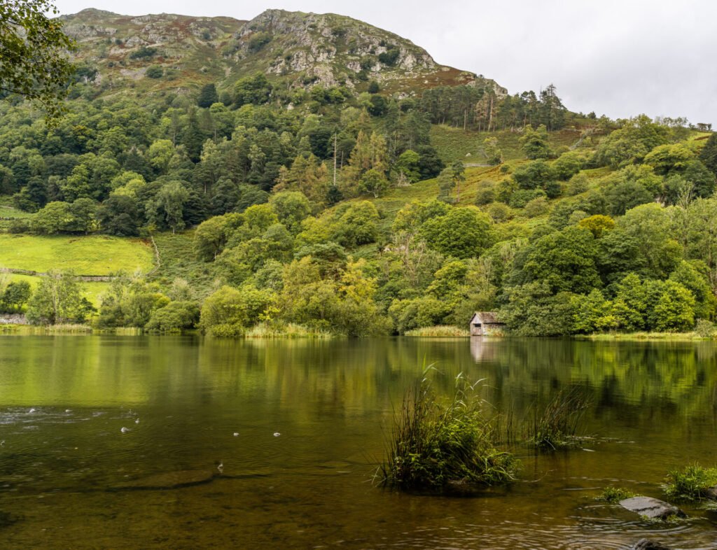
The Boathouse Version 2
I decided to look for other things to shoot but the rain put paid to that. Not expecting rain until the afternoon I hadn’t put my waterproof trousers on, let’s just say that was a mistake, I was very wet. The benefits of having a big car mean you can change trousers without anyone seeing!!
Day Five
It’s typical isn’t it that the day I was travelling home would have the best weather, but hey ho! As I had breakfast I hatched a plan to drive to the northern end of Thirlmere Reservoir and take images from there and see what else I could find. I’m not sure why but I decided to take the road at the southern end and drive the length of the reservoir on that side. I’m glad I did.
The car park at the northern end of Thirlmere was closed, as was the access road, but undeterred I parked up and set off for the dam wall. It was great to finally have blue skies and warm weather, although I did have the waterproof trousers on and the jacket in my bag I didn’t need them.
There is a huge monument I guessed you could describe it as that states when the reservoir was opened and by whom, and that this was by the Manchester Water Corporation, who knew!!
The view from the dam wall is spectacular and this was helped by the blue skies and light that was falling all over the fells around Thirlmere. These two images are from the shoot at the dam wall and capture the surroundings as well as some of the manmade elements which you can see if you look closely at the black hose or pipe that stretches out across the water.
North End Dam 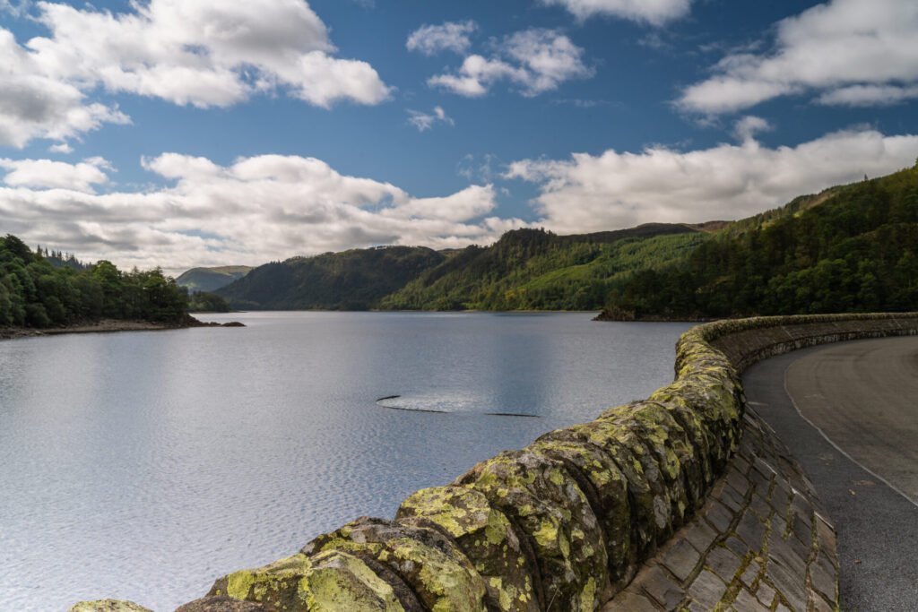
North End dam
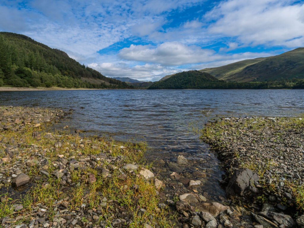
The drive up to the northern end showed me where the official car parks where as well as a few laybys that were still in use. Quite a few have been blocked off, I only assume to deter camper vans!! The first layby stop I could see that there was a beach and having explored a little I discovered the way down. The water level wasn’t low but you could see that this beach could be underwater quite easily. This makes for some great patterns and textures as I’d discovered on Glenridding beach.
I stumbled across a small fire pit that someone had made alongside an old tree branch, which clearly had been burnt in the fire pit. This was great foreground interest and this next image is of that pit and tree with the Helvellyn range of fells in the background.
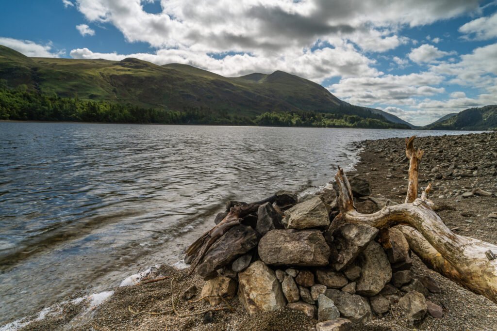
The Fire Pit
There are a good number of official car parks provided by United Utilities around Thirlmere and these where not very busy at all. I pulled into Armboth Car Park and found a number of families with inflatable boats having a great time near the shore.
All over this beach are lots of stones, small rocks and boulders and formations of these made from streams of water coming down off the fells. The next image here is of one of these streams as it enters the reservoir and the wonderful shapes that they can make. This provides great foreground interest with the fells again in the background.
The Stream
As I explored the beach I found a small stone circle that clearly had been made by a family on the beach and this made for a great picture again with the Hellvelyn range of fells behind it.
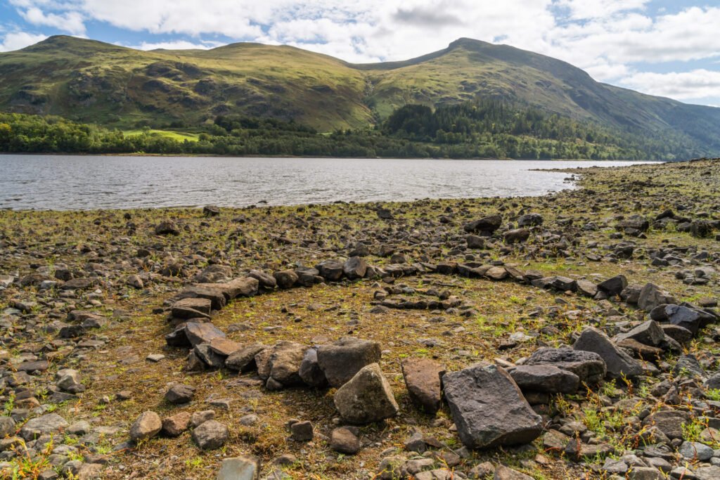
The Stone Circle
The final image is looking back towards the north end of the reservoir but with the rest of the Hellvelyn range of fells this time in the background.
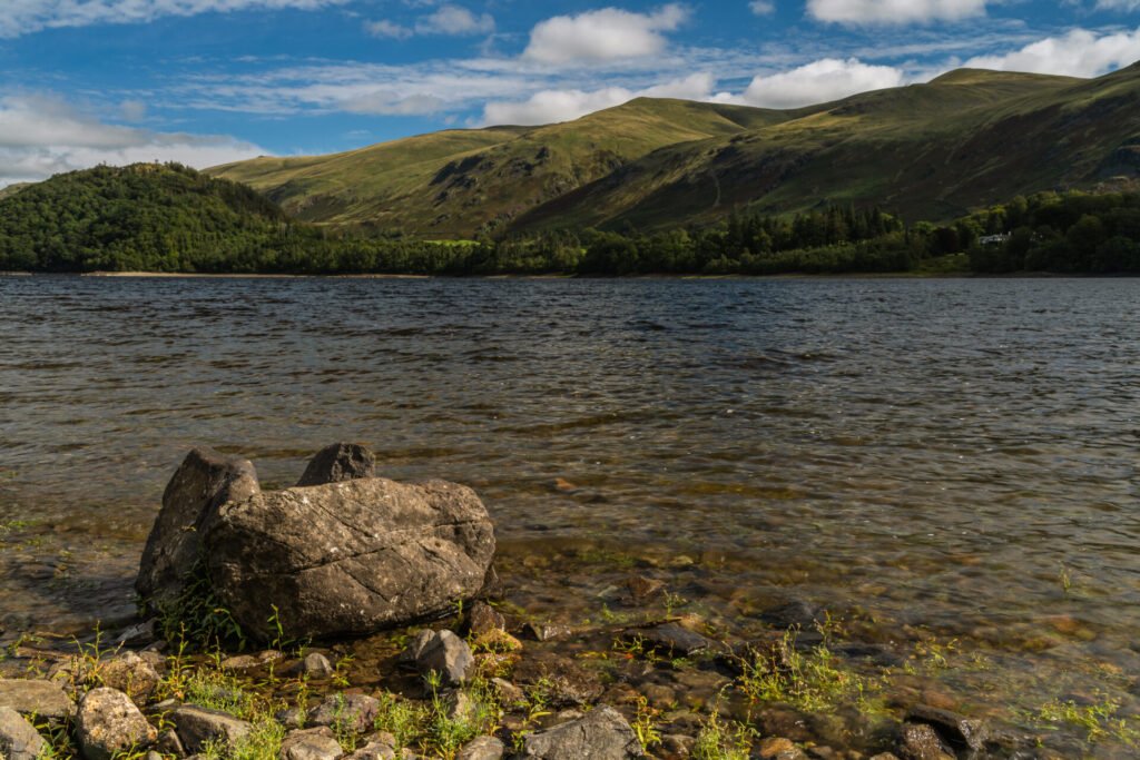
The Final Image of The Trip
What a fabulous five days of photography I had had. My drive back to Manchester was easy enough but I was staggered at the sheer volume of traffic that sat on the roads between the M6 and Windermere. It’s no exaggeration to say most of that stretch of road was at a standstill going into the Lakes. Great for the economy but I’m not sure there is enough infrastructure in place to cope. Yes I know I was there for a holiday to, this is the dilemma we all face staying in England for holidays, it is really a very small island.
I think you are doing so good with all the photos. I like the Rydal lone tree, version 1 & 2. I also think brothers water is lovely the photos are great. Lot of detail of your weekend.
Thank you, I had a great time 👍🏻
Great photos Steve, really like The Boathouse 1 shot and the Lone tree photos.
Thanks Les 👍🏻
Greetings from Florida! I’m bored to death at work so I decided to browse your site
on my iphone during lunch break. I really like the information you provide here and can’t wait to
take a look when I get home. I’m amazed at how fast your blog loaded on my mobile ..
I’m not even using WIFI, just 3G .. Anyways, excellent site! https://npseniorliving.com/communities/highland-park/