The government, rather confusingly, brought in some changes to the lockdown arrangements and whilst I’m not absolutely sure what the changes really are, we are allowed to go slightly further to exercise and for longer periods. Whilst this may well be the case I’m not wanting to go to places that will be absolutely rammed with folk just yet, but equally I was itching to get out with the camera and explore new places and look at something different than my own four walls. So, this blog is a short story of my weekend just gone (22/23/24th May 2020).
Higger Tor and Burbage Bridge (Friday 22nd May)
I decided that I wanted to get out into the hills but felt that a trip to the Lake District is just not the right thing to do at this point, so opted for the Peak District. Having half an idea about where to go is generally a good idea, so I consulted my trusty book of Walks around the peak district and looked for one of the gentler routes. The book described it as a gentle 6.5 mile walk, which was easy underfoot, which in truth it is. Having made a false start with the Sat Nav directions I found myself on the side of the road just below Higger Tor, god knows how but here I was.
My first thought on setting off up the path was “blooming eck” its damn windy here, and when I say windy, I mean WINDY, it was blowing an absolute gale. Undeterred I carried on up onto the top of Higger Tor. There are some wonderful views, awesome rock formations, rolling countryside but the wind was blowing my big Benro tripod (and that’s sturdy) all over the place. I eventually found a sheltered spot locking over towards the roman settlement (I think) called Carl Wark, which is huge stoney outcrop now, and this is the first picture below.
I decided to move on and the road I was parked on eventually led me to the car park at Upper Burbage Bridge, this felt more like what I’d read in the walking book, so I parked up and set off around the path to see what I could find. Along this trail where the Burbage Rocks but also a single tree arched in the wind, which clearly blows on a regular basis around here. I took quite a few images of this tree from different angles but the second picture shows the tree and a view along down the valley towards the previously mentioned Carl Wark.
It seemed to me that given that I was surrounded by all these rocks that I should try to get an image that made use of the rocks. By this time I’d been wandering around for at least 90 minutes in this howling gale, and I remembered I had a flask of coffee in the car. So I decided to head back to the car. As I walked back along the path I spotted the small set of stones that you can see in the third image, these always make a good foreground element to an image and the sweeping valley made up the rest of this image.
My stomach was rumbling so I decided, what with being very windswept, that I should head home and eat.
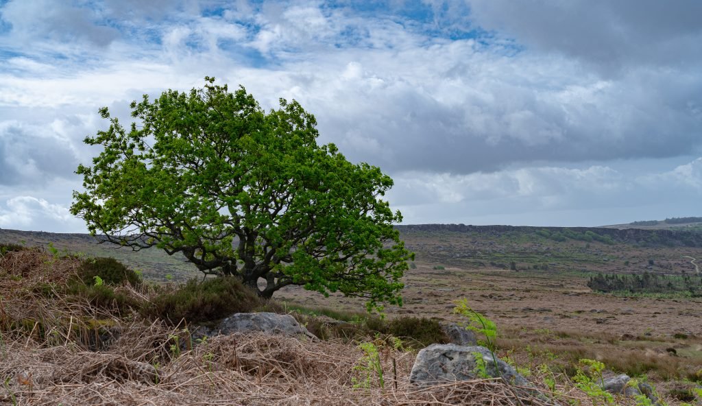
The Tree looking into the valley

Looking towards Carl Work 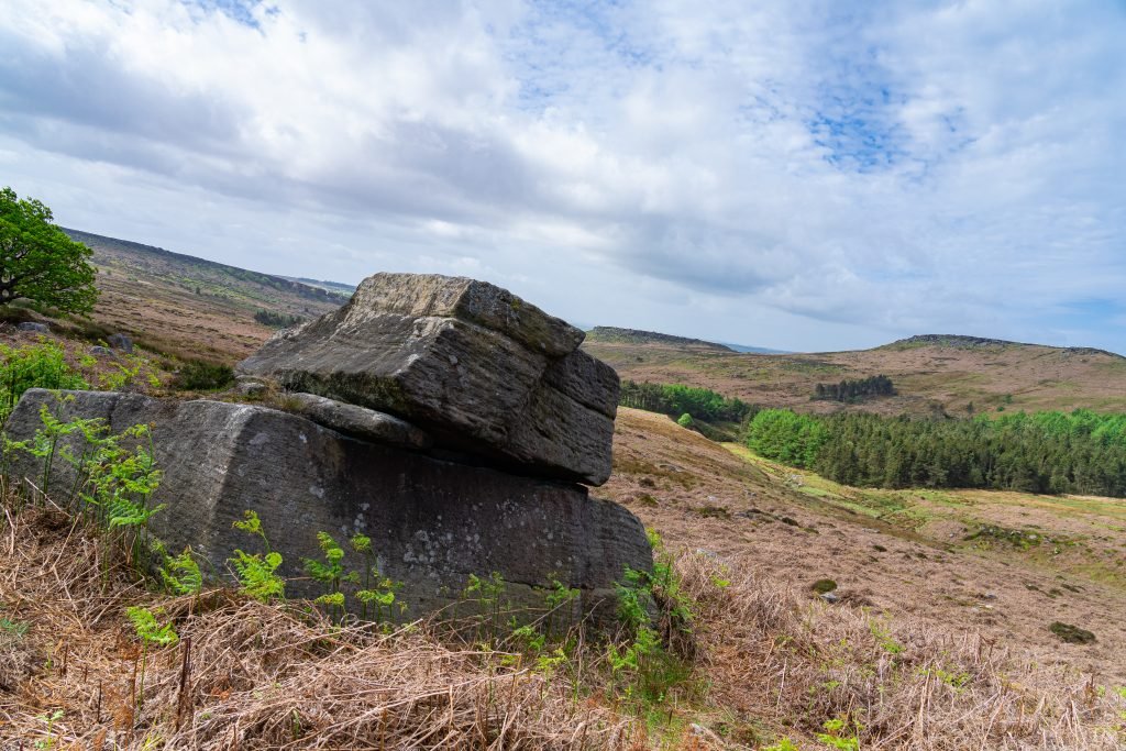
There are stones everywhere!!
River Mersey at Stockport (Transpennine Trail – Saturday 23rd May)
I’d heard a lot about the River Mersey that runs through Stockport over the years but hadn’t really ventured very far along it. I have taken images of the bridge at Parrswood, where the river runs under, but that’s about it. My mate Paul is a font of knowledge of local walks as he used to walk his dogs all around the local area. A quick text exchange with Paul convinced me that I should walk along the River Mersey from Stockport to the bridge at Parrswood and then back through Abney Hall Country Park.
I have to say I was very pleasantly surprised at what I found walking along the banks of the River Mersey. There is a wide variety of things to see as well as history and wildlife, plus the more modern aspects which are the M60 and views at the new industrial units on the opposite side of the bank.
As I walked I came across the ruins of some old structure on the opposite bank, and as I stood there trying to work out what it was I saw a lady reading a sign. Once she had moved on the sign told me that the old structure that I saw was infact part of an old bridge over the Mersey that was used by the railway. Fascinating stuff indeed and the first image you see here is the ruins of the railway bridge and I think you’ll agree with me that it probably was an impressive structure in its pomp.
I continued along the Mersey trail and was amazed at the variety of things to look at, as well as the trail being great to exercise, as several runners and bike riders navigated around me in a correct socially distant manner. As well as all the things to see along the trail, the centre piece of the walk is of course the river. Whilst it meanders quite sedately through this part of Stockport, it’s hard to believe that a few short miles further on this is the huge River Mersey running out to sea at Liverpool. The second image is low down close to the edge of the river looking over towards Cheadle in the distance, and I was quite surprised how far into the river I could get to take this image, and I didn’t get my feet wet, honest!
Soon enough I was back on familiar ground at the bridge at Parrswood, and I set off towards Abney Hall, this route is on the main road, over the top of the M60 and then down into the grounds of Abney Hall. This is a great place to have a wander around, but was quite busy, so I decided to cut through the edge of the trail that leads around and head home. As I walked I looked up and saw across a field at some lovely flowers growing in a field at the side of the trail. It’s hard to believe that the third image was taken literally only a few hundred yards from the M60, I am lucky to have some countryside (ish) on my doorstep for sure.
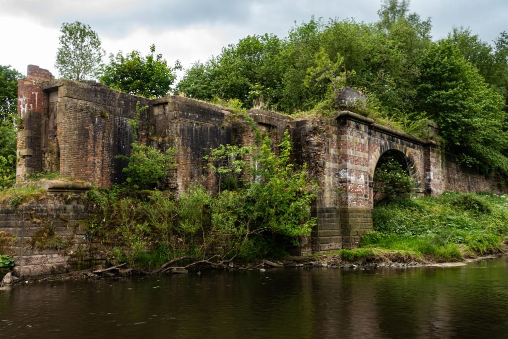
Old Railway Bridge
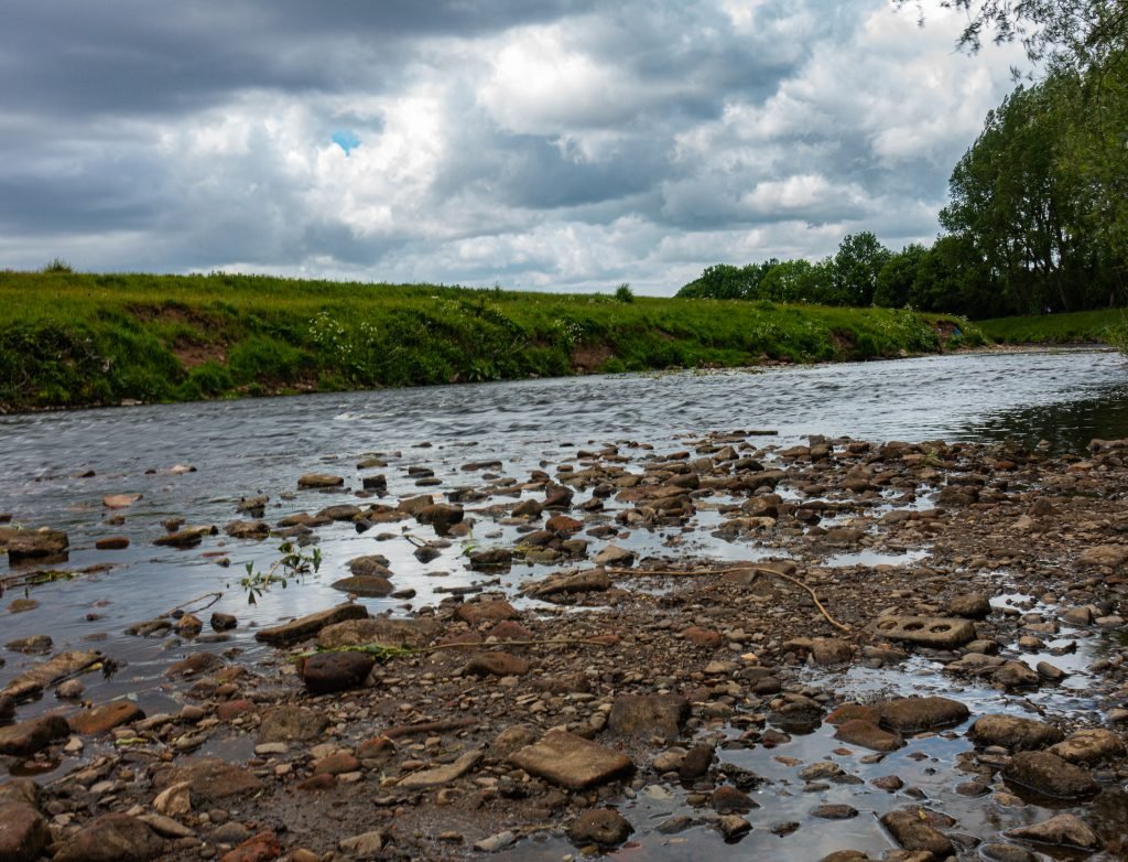
River Mersey looking towards Cheadle 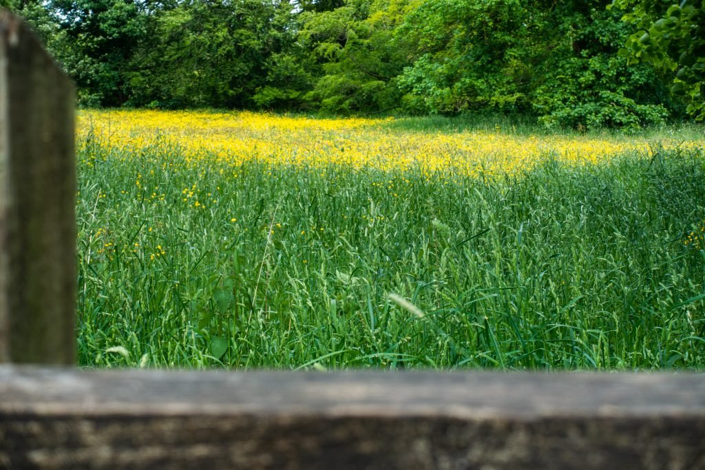
Fields of flowers in Abney Hall Country Park
Ladybower Reservoir
I drove home after having played a socially distanced round of golf, and was feeling really good. The hand operation has not stopped me playing golf, despite having to grip the clubs slightly differently, but hey ho I can still hit the ball as I always could.
So feeling this exuberance I decided I’d have a trip out to another part of the Peak District and see what I could find at Ladybower Reservoir. The internet is full of images of the overflow holes in the reservoir and I decided to find them for myself, but I wasn’t hopeful of much water flowing down them as it’s been very dry recently. The first image is of one of the overflows, without an water, impressive either way but I’ll be back later in the year to get the image of the water flowing down.
As you drive along the A57 (Snake Pass) you cross over two bridges, so I decided to take an image of both bridges. I walked along the main road past Heatherdene car park on my right and saw a slipway down from the road to the reservoir, but this is a private yachting and angling route to the waters edge. Undeterred I climbed over the wall (yes I climbed) and headed down to the waters edge, across a rocky beach area. The second image shows the bridge from low down on the beach, quite close to the waters edge.
To get to the second bridge I needed to get back into my car and drive back the way I came an hour or so previously. Rather than take a shot of the second bridge low down I wanted to get a more panoramic view of the bridge and the valley that Ladybower Reservoir sits in the bottom of. I really like these images from what was an impromptu trip out.
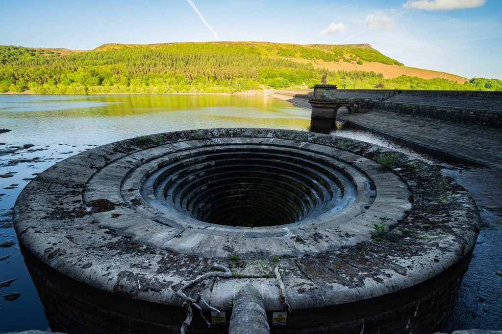
Overflow number 1
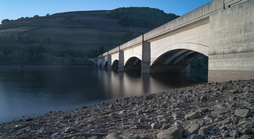
Bridge from the beach 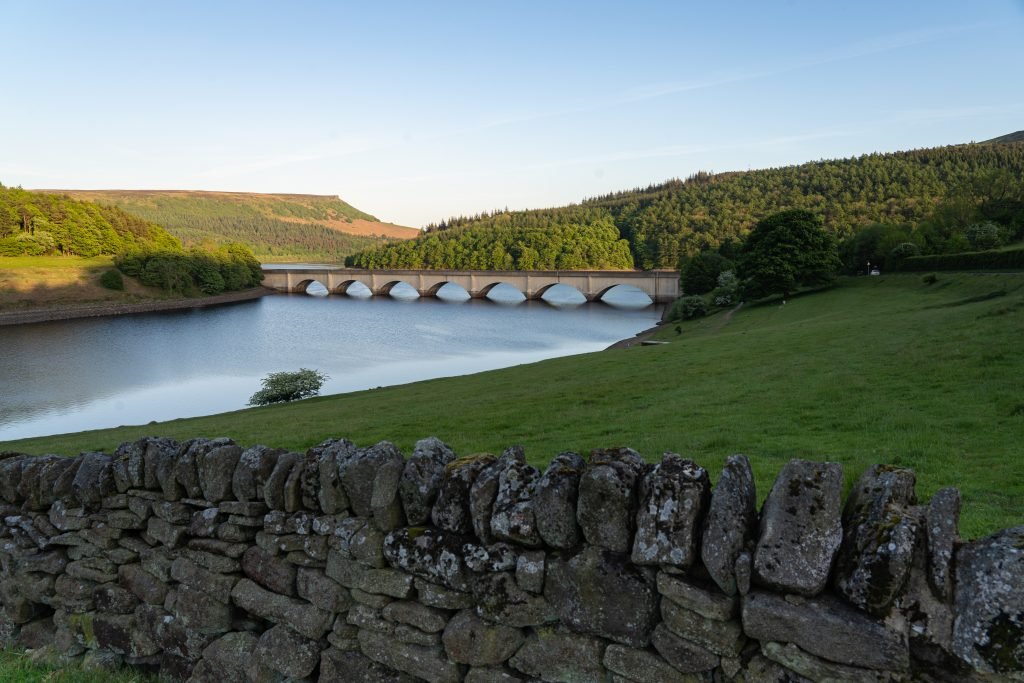
Bridge and the valley